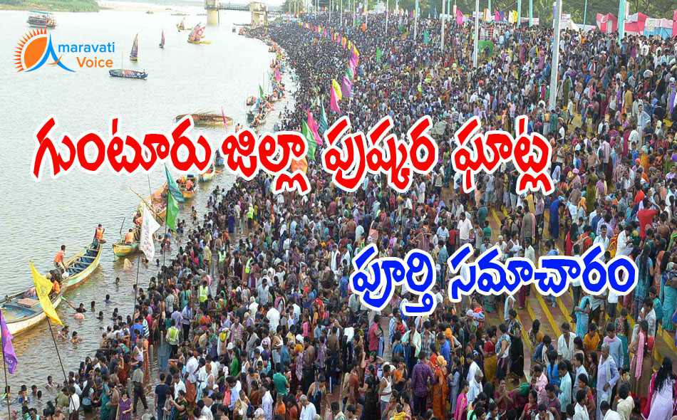
Here is the completed list of Pushkar Ghats in Guntur District. From here, you can find the nearest bus stand to the ghat, nearest railway station to the ghats, temples available near to the ghat, nearest police station to the ghat, nearest health care center the th ghats.
Veerlapalem Ghat
- Nearest Temple Site: Ramalayam Temple
- Distance from Nearest Main Road: 0.25 Km
- Approach Road to Ghat: 1.5 Km
- Nearest Bus Stand to the Ghat: 2 Km
- Nearest Railway Station: 15 Km
- Nearest PHC/ Area Hospital: Nutakki 5KM
- Nearest Police Station: Duggirala PS 16 KM
Pedakonduru Ghat
- Nearest Temple Site: Rajeswari Ammavari Temple
- Distance from Nearest Main Road: 1.5 KM to Karakatta
- Approach Road to Ghat: MVD Road & C.C.Road
- Nearest Bus Stand to the Ghat: 2 Km
- Nearest Railway Station: 16 KM Pedavadlapudi
- Nearest PHC/ Area Hospital: Emani 12 KM
- Nearest Police Station: Duggirala PS 16 KM
Godavarru Ghat
- Nearest Temple Site: Sivalayam Temple, Ramalayam Temple
- Distance from Nearest Main Road: 0.25 Km
- Approach Road to Ghat: 1.5 Km
- Nearest Bus Stand to the Ghat: 0.25 Km
- Nearest Railway Station: 18KM Pedavadlapudi
- Nearest PHC/ Area Hospital: Emani 12 KM
- Nearest Police Station: Duggirala PS 16 KM
VP SOUTH KRISHNAVENI Ghat
- Nearest Temple Site: Bramhamgari Matam 200mts,Saibaba Temple500 mts,Sivalayam Temple200 mts
- Distance from Nearest Main Road: 100 Mts
- Approach Road to Ghat: Available
- Nearest Bus Stand to the Ghat: 1 Km
- Nearest Railway Station: 27 KM Macherla Railway Station
- Nearest PHC/ Area Hospital: 1/2 Km Community Health Centre 20 Beds Hospital
- Nearest Police Station: V.P. South Police Station 400 mts
Veerlapalem Ghat
- Nearest Temple Site: Ramalayam Temple
- Distance from Nearest Main Road: 0.25 Km
- Approach Road to Ghat: 1.5 Km
- Nearest Bus Stand to the Ghat: 2 Km
- Nearest Railway Station: 15 Km
- Nearest PHC/ Area Hospital: Nutakki 5KM
- Nearest Police Station: Duggirala PS 16 KM
Rentachintala Mandal Satrasala Ghat-1 & 2
- Distance from Nearest Main Road: 1 KM
- Nearest Bus Stand to the Ghat: Satrasala Bus Stand
- Nearest Railway Station: Rentachintala
- Nearest PHC/ Area Hospital: Rentachintala
- Nearest Police Station: Rentachintala
VP SOUTH KRISHNAVENI Ghat
- Nearest Temple Site: Bramhamgari Matam 200mts,Saibaba Temple500 mts,Sivalayam Temple200 mts
- Distance from Nearest Main Road: 100 Mts
- Approach Road to Ghat: Available
- Nearest Bus Stand to the Ghat: 1 Km
- Nearest Railway Station: 27 KM Macherla Railway Station
- Nearest PHC/ Area Hospital: 1/2 Km Community Health Centre 20 Beds Hospital
- Nearest Police Station: V.P. South Police Station 400 mts
Ragulagadda Ghat
- Distance from Nearest Main Road: 15 Km
- Approach Road to Ghat: Available
- Nearest Bus Stand to the Ghat: State HighWay
- Nearest Railway Station: Piduguralla
- Nearest PHC/ Area Hospital: PHC in Machavaram
- Nearest Police Station: Machavaram
Vallampalli Ghat
- Distance from Nearest Main Road: 15 Km
- Approach Road to Ghat: Available
- Nearest Bus Stand to the Ghat: State HighWay
- Nearest Railway Station: Piduguralla
- Nearest PHC/ Area Hospital: PHC in Machavaram
- Nearest Police Station: Machavaram
Govindapuram Ghat
- Nearest Temple Site: Lord Anjaneya Swamy simple Temple
- Distance from Nearest Main Road: 18 Km
- Approach Road to Ghat: Available
- Nearest Bus Stand to the Ghat: State HighWay
- Nearest Railway Station: Piduguralla
- Nearest PHC/ Area Hospital: PHC in Machavaram
- Nearest Police Station: Machavaram
Sitanagaram - 1 & 2 Ghat
- Nearest Temple Site: Sri Kodanda Ramanjaneya swamy vari Temple
- Distance from Nearest Main Road: 0.5 K.M
- Approach Road to Ghat: Old NH-5 Near Kanaka Durga Varadi east side
- Arrangements at Pushkar Nagar: Krishna Canal Tadepalli
- Nearest Bus Stand to the Ghat: Kanaka Durga Varadhi
- Nearest Railway Station: Krishna Canal
- Nearest PHC/ Area Hospital: Sitanagaram
- Nearest Police Station: Tadepalli PS
Nandulurevu Ghat H/0 Madipadu (V)
- Nearest Temple Site: Uttaravahini / Uttarakasi Pulichintala (KLRao Sagar) Project
- Distance from Nearest Main Road: 0.5Km 3.0Km
- Approach Road to Ghat: Available
- Nearest Bus Stand to the Ghat: 5Kms
- Nearest PHC/ Area Hospital: PHC, Atchampet
- Nearest Police Station: Atchampet
Ramapuram Ghat
- Nearest Temple Site: Gangamma, Seetharaswamy Temples
- Distance from Nearest Main Road: 3.5 Km
- Approach Road to Ghat: Available
- Nearest Bus Stand to the Ghat: State HighWay
- Nearest Railway Station: Pondugala
- Nearest PHC/ Area Hospital: PHC in ICL Cement Factory
- Nearest Police Station: Dachepalli
Bhatrupalem Ghat
- Nearest Temple Site: Lakshmi Narasihma Swamy Temple
- Distance from Nearest Main Road: 1.0 Km
- Approach Road to Ghat: Available
- Nearest Bus Stand to the Ghat: Bhatrupalem
- Nearest Railway Station: Nadikudi
- Nearest PHC/ Area Hospital: Dachepalli
- Nearest Police Station: Dachepalli
Katrapadu Ghat
- Nearest Temple Site: Sri Seetharamaswamy Temple
- Distance from Nearest Main Road: 1.5 Km
- Approach Road to Ghat: Available
- Nearest Bus Stand to the Ghat: Katrapadu
- Nearest Railway Station: Nadikudi
- Nearest PHC/ Area Hospital: Dachepalli
- Nearest Police Station: Dachepalli
Tangeda Ghat
- Nearest Temple Site: Lord Venkateswara Swamy
- Distance from Nearest Main Road: Direct to Tangeda Revu
- Approach Road to Ghat: Available
- Nearest Bus Stand to the Ghat: Tangeda village
- Nearest Railway Station: Nadikudi
- Nearest PHC/ Area Hospital: Sub- Centre
- Nearest Police Station: Dachepalli
Amaravathi - A & B Ghat
- Nearest Temple Site: Amaralingeswara Swamy Temple, Amaravathi
- Distance from Nearest Main Road: 1.0 Km
- Approach Road to Ghat: Available
- Nearest Bus Stand to the Ghat: 1.0 Km
- Nearest Railway Station: Pedakurapadu Railway station 23Km
- Nearest PHC/ Area Hospital: 0.25 Km
- Nearest Police Station: 1.0 Km
Vykuntapuram Ghat
- Nearest Temple Site: Sri Crownchagiri Venkateswara Swami Temple, Vykuntapuram
- Distance from Nearest Main Road: 1.5 Km
- Approach Road to Ghat: Available
- Nearest Bus Stand to the Ghat: 1.5 Km
- Nearest Railway Station: Pedakurapadu Railway station 33Km
- Nearest PHC/ Area Hospital: 10 Km
- Nearest Police Station: 12 Km
Harichandrapuram-A & B Ghat
- Nearest Temple Site: SHIVALAYAM IS LOCATE AT ADJACENT OF GHAT
- Distance from Nearest Main Road: 1 Km
- Approach Road to Ghat: Available
- Nearest Bus Stand to the Ghat: HARICHANDRAPURAM
- Nearest Railway Station: VIJAYAWADA
- Nearest PHC/ Area Hospital: THULLURU
- Nearest Police Station: THULLURU
Borupalem Ghat
- Nearest Temple Site: OLD SIVALAYAM
- Distance from Nearest Main Road: 2 Km
- Approach Road to Ghat: Available
- Nearest Bus Stand to the Ghat: BORUPALEM
- Nearest Railway Station: VIJAYAWADA
- Nearest PHC/ Area Hospital: THULLURU
- Nearest Police Station: THULLURU
RAYAPUDI Ghat
- Nearest Temple Site: OLD SIVALAYAM AT RAYAPUDI
- Distance from Nearest Main Road: 2 Km
- Approach Road to Ghat: Available
- Nearest Bus Stand to the Ghat: RAYAPUDI
- Nearest Railway Station: VIJAYAWADA
- Nearest PHC/ Area Hospital: THULLURU
- Nearest Police Station: THULLURU
TALLAYAPALEM-A & B Ghat
- Nearest Temple Site: SAIVAKSHETRAM
- Distance from Nearest Main Road: 2 Km
- Approach Road to Ghat: Available
- Nearest Bus Stand to the Ghat: MANDADAM
- Nearest Railway Station: VIJAYAWADA
- Nearest PHC/ Area Hospital: MANDADAM
- Nearest Police Station: MANDADAM OUT POST
Prathuru Ghat
- Distance from Nearest Main Road: 2 Km
- Approach Road to Ghat: Krishna River Right flood bank
- Nearest Bus Stand to the Ghat: Muvva Sesharatnam Bus Shelter
- Nearest Railway Station: Krishna Canal
- Nearest PHC/ Area Hospital: Sitanagaram
- Nearest Police Station: Tadepalli PS
Vallampalli Ghat
- Distance from Nearest Main Road: 15 Km
- Approach Road to Ghat: Available
- Nearest Bus Stand to the Ghat: State HighWay
- Nearest Railway Station: Piduguralla
- Nearest PHC/ Area Hospital: PHC in Machavaram
- Nearest Police Station: Machavaram
Chirravuru Ghat
- Distance from Nearest Main Road: 4 Km
- Approach Road to Ghat: Krishna River Right flood bank
- Nearest Railway Station: Krishna Canal
- Nearest PHC/ Area Hospital: Sitanagaram
- Nearest Police Station: Tadepalli PS
Sitanagaram - 1 & 2 Ghat
- Nearest Temple Site: Sri Kodanda Ramanjaneya swamy vari Temple
- Distance from Nearest Main Road: 0.5 K.M
- Approach Road to Ghat: Old NH-5 Near Kanaka Durga Varadi east side
- Arrangements at Pushkar Nagar: Krishna Canal Tadepalli
- Nearest Bus Stand to the Ghat: Kanaka Durga Varadhi
- Nearest Railway Station: Krishna Canal
- Nearest PHC/ Area Hospital: Sitanagaram
- Nearest Police Station: Tadepalli PS
Athalurivaripalem Ghat
- Nearest Temple Site: Sai Baba Temple
- Distance from Nearest Main Road: 50Mtrs
- Approach Road to Ghat: Available
- Nearest Bus Stand to the Ghat: Yes
- Nearest PHC/ Area Hospital: Munnangi
- Nearest Police Station: Kollipara
Vallabhapuram Ghat
- Nearest Temple Site: Tirupatamma Temple
- Distance from Nearest Main Road: 50Mtrs
- Approach Road to Ghat: Available
- Nearest Bus Stand to the Ghat: Yes
- Nearest PHC/ Area Hospital: Munnangi
- Nearest Police Station: Kollipara
Munnangi Ghat
- Nearest Temple Site: Tirupatamma Temple
- Distance from Nearest Main Road: 0.5 Mtrs
- Approach Road to Ghat: Available
- Nearest Bus Stand to the Ghat: Yes
- Nearest PHC/ Area Hospital: Munnangi
- Nearest Police Station: Kollipara
Munnangi Ghat
- Nearest Temple Site: Sai Baba Temple
- Distance from Nearest Main Road: 400 Mtrs
- Approach Road to Ghat: Available
- Nearest Bus Stand to the Ghat: Yes
- Nearest PHC/ Area Hospital: Munnangi
- Nearest Police Station: Kollipara
Kollipara B Ghat
- Nearest Temple Site: Tirupatamma Temple
- Distance from Nearest Main Road: 100 Mtrs
- Approach Road to Ghat: Available
- Nearest Bus Stand to the Ghat: Yes
- Nearest PHC/ Area Hospital: Munnangi
- Nearest Police Station: Kollipara
Kollipara A Ghat
- Nearest Temple Site: Tirupatamma Temple
- Distance from Nearest Main Road: 50 Mtrs
- Approach Road to Ghat: Available
- Nearest Bus Stand to the Ghat: Yes
- Nearest PHC/ Area Hospital: Munnangi
- Nearest Police Station: Kollipara
Kotha Bommuvanipalem Ghat
- Distance from Nearest Main Road: 2 Mtrs
- Approach Road to Ghat: Available
- Nearest Bus Stand to the Ghat: Yes
- Nearest PHC/ Area Hospital: Munnangi
- Nearest Police Station: Kollipara
Bommuvanipalem Ghat
- Nearest Temple Site: Srirama Temple
- Distance from Nearest Main Road: 400 Mtrs
- Approach Road to Ghat: Available
- Nearest Bus Stand to the Ghat: Yes
- Nearest PHC/ Area Hospital: Munnangi
- Nearest Police Station: Kollipara
Nandulurevu Ghat H/0 Madipadu (V)
- Nearest Temple Site: Uttaravahini / Uttarakasi Pulichintala (KLRao Sagar) Project
- Distance from Nearest Main Road: 0.5Km 3.0Km
- Approach Road to Ghat: Available
- Nearest Bus Stand to the Ghat: 5Kms
- Nearest PHC/ Area Hospital: PHC, Atchampet
- Nearest Police Station: Atchampet
Madipadu Ghat
- Nearest Temple Site: Sri Parvathi Sametha Ramalingeswara Swamy Temple ;Saradhambha Temple ; Sattemma Temple
- Distance from Nearest Main Road: 0.0 Km
- Approach Road to Ghat: Available
- Nearest Bus Stand to the Ghat: 0.25 Kms
- Nearest PHC/ Area Hospital: PHC, Atchampet
- Nearest Police Station: Atchampet
Ginjupalli Ghat
- Nearest Temple Site: Sri Kasi visweswara swamy Temple
- Distance from Nearest Main Road: 0.0 Km
- Approach Road to Ghat: Available
- Nearest Bus Stand to the Ghat: 0.5 Kms
- Nearest PHC/ Area Hospital: PHC, Atchampet
- Nearest Police Station: Atchampet
Taduvai Ghat
- Nearest Temple Site: Sivalayam Temple
- Distance from Nearest Main Road: 0.5 Km
- Approach Road to Ghat: Available
- Nearest Bus Stand to the Ghat: 0.5 Kms
- Nearest PHC/ Area Hospital: PHC, Atchampet
- Nearest Police Station: Atchampet
Chintapalli Ghat
- Nearest Temple Site: Sri Vishnu Murthy Temple
- Distance from Nearest Main Road: 0.0 Km
- Approach Road to Ghat: Available
- Nearest Bus Stand to the Ghat: 0.5 Kms
- Nearest PHC/ Area Hospital: PHC, Atchampet
- Nearest Police Station: Atchampet
Chamarru Ghat
- Nearest Temple Site: Sri Siddi Vinayaka Temple ; Sri Veera Bhadra Swamy Temple ; Sri Boddurayi Anjaneya Swamy temple
- Distance from Nearest Main Road: 0.5 Km;0.5 Km;2.0 Km
- Approach Road to Ghat: Available
- Nearest Bus Stand to the Ghat: 2 Kms
- Nearest PHC/ Area Hospital: PHC, Atchampet
- Nearest Police Station: Atchampet
Kogantivaripalem Ghat
- Nearest Temple Site: Sivalayam
- Distance from Nearest Main Road: 2.0 Km
- Approach Road to Ghat: Available
- Nearest Bus Stand to the Ghat: 1.0 Kms
- Nearest PHC/ Area Hospital: PHC, Atchampet
- Nearest Police Station: Atchampet
Konuru Ghat
- Nearest Temple Site: Sivalayam Temple ;
- Thirupathamma Temple
- Distance from Nearest Main Road: 0.5 Km
- Approach Road to Ghat: Available
- Nearest Bus Stand to the Ghat: 0.8 Kms
- Nearest PHC/ Area Hospital: PHC, Atchampet
- Nearest Police Station: Atchampet